Showing posts with label Sydney Harbour Walk. Show all posts

Wednesday, 3 July 2013

A Sydney Harbour Walk - Spit Bridge to Manly

After 2, 000, 000 days of rain, the Sydney-ers came out on Monday for the first day of full sunshine.

I had big plans for the day--an ambitious 10K walk from Spit Bridge to Manly. I thought I had prepared adequately, a baggie of cut up apple, a hat, my new "Walking Sydney" book (I left the Coastal Walks book at home...to my later regret).


I took a bus from our house to Spit Bridge, which is probably the easiest bus ride to anywhere you can take because you literally look out the window until you get to a bridge...and then you get off --> HURRAY!

Spit Bridge is nothing much to look at (it's actually pretty ugly):


The walk starts under the bridge in a little parkette. Almost immediately, you are plunged into a quiet rainforest, which is actually only 5 minutes from the busy roadway and about 500 feet away from private residences. It was so quiet and jungle-like-- I was in HEAVEN!


Like a lot of Sydney's harbour walks, there are bits of beaches and little bays full of boats all along the way...which is what harbours are all about I guess.


However, my favourite parts were always the jungle trails. I LOVE LOVE LOVE ROMPING THROUGH THE JUNGLE! It's not only a great workout (hopping stone to stone, avoiding puddles, leaping, etc.), but the air is densely green-smelling and refreshing.
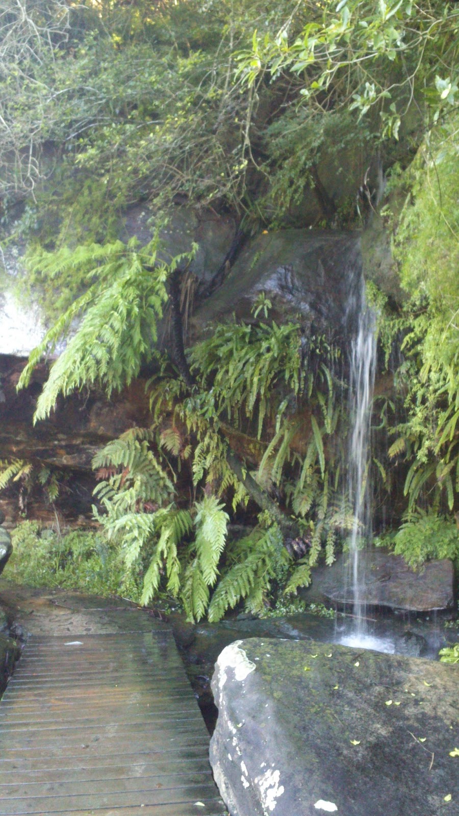

YES THAT'S A WATERFALL OMG.


Some bright algae growth on the rock walls.


There are 2 detours along this route to go inland if tides are high enough to wash out the trail. My guidebook didn't tell me anything about this, but it is very easy to get back on the right track. Just follow the "MSW" signs - Manly Spit Walk. In fact, this is one of the BEST marked city trails I've been on (Ok, but I haven't really been on so many).


I took a little detour off the main route to Manly to see Grotto Point. My book didn't say very much about Grotto Point, except indicate a lighthouse at the very end of the walk. The map it provided was essentially useless, GPS on my phone was useless, so I was left to my own devices. Luckily, some kind hikers had hand-written "GROTTO PT" on one of the many blue guideposts.


I could definitely see why the government doesn't want you to go this way.

IT IS MUDDY, SLIPPERY, DOWNHILL AND VERY DIFFICULT AFTER THE RAIN. All I can say is that my shoes did NOT do well:


Plus, you can't actually explore the lighthouse area because of unstable cliff edges.


By the time I climbed back up to the main trail, I was REALLY hungry. I was only about 4km into this 10K walk, so I devoured my apple, drank some water and tried to ignore my stomach.

Luckily, there were the Grotto Point Engravings to entertain me. These are Aboriginal engravings into rock.


Fish?


Boomerangs!

After all that climbing, the trail finally leveled off. For all my hard, muddy work this view was an AMAZING reward:


However, I still had more than 5K to go, so I snapped a pic, tightened my muddy laces, and set off.

The bush trail eventually ended at a tiny secluded beach, where I emerged from the trees looking like a jungle queen and possibly scaring the little kiddies and their parents sun bathing. But then again, maybe these Australians are used to it, and that's why they just ignored me.

The trail continued as a paved walk-way all the way to Manly.

By the way, did you know that Manly beach is home to the Little Penguin?


I was RAVENOUS by the time I got to Manly. I ordered a mint-orange juice and a veggie pita sandwich. I was so hungry I devoured it within seconds. My feet were muddy and cold, so I boarded the first bus home and went headfirst into a hot shower. My feet stank SO BAD after 3 hours in wet and muddy shoes that I had to scrub my feet like 5 times to get the mud out.

All my walking books have called this walk one of the "best" urban walks in Sydney. In my humble opinion, YES YES YES YES YES! Most of the walk is in pure jungle, which is my absolute favourite, with short breaks into beach/residential areas. It is separated from the pollution of main roadways, and extremely popular with walkers, runners, hikers, families and tourists. It is clearly marked, well maintained, and easy to follow.

The only thing I would do differently is bring a snack, like a granola bar, and a change of socks for wet feet (or purchase some waterproof hiking boots, but those are $$$. Ain't nobody got time for that).

Go get your MSW hike on. It is AWESOME.

Tuesday, 30 April 2013

A Sydney Harbour Walk: Where am I? No, seriously where am I?!

If you've been following my blog for a while now, you'll know that I enjoy wandering in small confusing circles without a map or phone. 

I did one better today and went for a Sydney Harbour Walk with both my phone AND a map, and I still got lost!

Can you imagine how great I'd be at navigating back in the compass and constellations days? Do not let me steer the ship!!

Anyway, I started my day by sleeping in, which I highly recommend when Ashtanga isn't on the schedule (cuz I know you really need to know why, it's my Ladies Holiday. WIN!).

I recommend long sleeves and long pants in case of low bushes that might scratch.


Thick pink socks are a must!

I decided beforehand to do a "short walk" so I could have some lazy time at home later. This 3km one is close to the city and easy to get home from - McMahons Point to Waverton.


But 3 KM in a wwwaayyyy is too little for an superstar like me. I thought I could up the ante by adding a few extra km by starting at Circular Quay and walking across the Sydney Harbour Bridge.

So I had basically added up 2 walks in my book; Circular Quay to Lavendar Bay + McMahons Point to Waverton = about 7 km.


Some of the highlights was a beautiful stretch of road behind Luna Park, in Lavendar Bay.


It takes you down to a seriously tiny beach, and then the road ends.

Where do you go next?

Don't ask me. This is where I got seriously lost. There's a little park once you cross under the train tracks, and a bunch of stairs that lead you to random residential streets. I think I went in 3 little circles, up the stairs, down the stairs, around the park, and back up the stairs before I decided to ask someone.

The answer is, THIS IS LAVENDAR BAY, NOT BLUES POINT RESERVE. You need to take Bay View Road and wind around the private residences before you can get to Blues Point Reserve. Luckily, Bay View Road is a small residential street without a lot of traffic, so it's a pleasant detour.

And it's well worth it. Blues Point Reserve is a beautiful little loop with great views.


From here on, it gets better and better. There's a small foray back into the residential streets, and then you get to Sawmiller's Reserve, which was my absolute FAVOURITE!

Take a look!


There's some sort of ship wreck washed up!

IN A CITY PARK!

A. CITY. PARK.

SHIPWRECK!

You cannot deny how cool this is!

The walk goes through Sawmillers Reserve and onto a boardwalk that leads to the North Sydney Marine Centre. You've got to get back onto the residential streets in order to go around the Marine Centre and back   to the water.

Eventually, you get to this fork in the road:


The higher one goes back to residential streets, while the lower one goes to a nice little sports field in Waverton Park.

From there, you can go to the BP Oil Station, which is a nice little walk I've done before, and about 10 minutes from home.

Like a proper lazy person, I decided to go home.

I had started my walk at 1:37. By the time I got home, it was 3:15! That's about an hour and a half walk! WOO HOO I'M A WALKING MONSTER!

Anyway, I rate this walk about a 7/10. It's filled with beautiful green spaces and some quieter residential streets. It's easy to do, peaceful and quiet. Much better than last week!

Tuesday, 23 April 2013

A Sydney Harbour Walk - Double Bay to Rose Bay

Since moving to our home in North Sydney, I've run/walked Balls Head Reserve many-oh-many a-time.

While it shames me to say it, I think I might even be getting bored of it!

So I decided first thing in the morning that I would change things up and try one of the many walks listed in this book:


Since it's on the train line, I decided to do this one: Double Bay to Rose Bay.


The pictures in the book were a little misleading, though the text was true to its word.

There are some beautiful views starting off at the small neighbourhood park, Steyne Park.


However, there beach right off Steyne Park doesn't connect to Double Bay, so you have to go back to the busy streets to get there.


You go through the Redleaf Pool area which is a public swimming part of the bay netted off from the rest of the bay with a jetty.


You go down some steps....


And there it is! You can walk along the jetty and enjoy some sun and breeze.

Then, it's back to the residential roads and lanes, which are quite disappointing because they are full of traffic, noise and smog on a Tuesday morning.

Finally, I made it to Rose Bay:


And was rewarded with this sweet little beach:


There was a Stand-Up Paddleboarding class going on and some kayakers enjoying the day.


I took these stairs out of the park and started to climb a little residential hill before I realized that I was missing a whole chunk of the walk!


You can sort of see it beyond the house in the foreground. There's a long section of the walk that goes beside the main street all around Rose Bay.

Whoops.

Anyway, a 2 hr walk was enough for me, especially since I had a date with some Mexican.


Perfect way to end a long walk!

I would only rate this walk a 4/10 since it takes you down too many main streets with very little time in comparison by the harbour (then again, I did miss a chunk of it).

I had downloaded and listened to 2 Radiolab podcasts: Bliss and Inheritance. Both were extremely excellent and engaging. I can't wait to download more for my walk next week!

Happy Tuesday everyone!